Lines in the Sand: How Bureaucrats with Rulers Created Most of the World's Permanent Wars
Lines in the Sand: How Bureaucrats with Rulers Created Most of the World's Permanent Wars
The most destructive technology of the past five hundred years was not gunpowder, nuclear weapons, or chemical warfare. It was the surveyor's chain and the cartographer's pen. More people have died defending lines drawn by bureaucrats who never visited the territories they were dividing than have died for any religious doctrine or ethnic hatred in human history.
The Cartographer's Delusion
Human psychology operates on a principle that mapmakers consistently ignore: people develop attachments to places, not to abstract geometric concepts. Yet virtually every major territorial conflict currently destabilizing international relations originated when someone decided that complex human geography could be simplified into straight lines and precise coordinates.
The Kashmir conflict, which has brought two nuclear powers to the brink of war repeatedly since 1947, exists because a British civil servant named Cyril Radcliffe spent five weeks in 1947 drawing borders through a region he had never visited, dividing communities that had coexisted for centuries according to religious demographics he understood only through census data.
Radcliffe's line cut through villages, separated families, and divided agricultural communities from their traditional water sources and markets. The resulting borders were precise, legally defined, and completely divorced from the human reality they were meant to govern. Seventy-five years later, the subcontinent remains locked in a conflict that traces directly to those five weeks of bureaucratic cartography.
The Colonial Laboratory
European colonial administration created the modern template for bureaucratic border-making, establishing patterns that continue to generate conflicts today. The Berlin Conference of 1884-1885 demonstrates how the technology of mapmaking could create decades of future violence through a single afternoon's work.
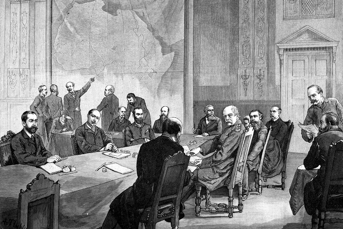 Photo: Berlin Conference, via i0.wp.com
European diplomats gathered in Berlin to divide Africa among themselves using maps that were often inaccurate and always incomplete. They drew straight lines across deserts, bisected river systems, and separated ethnic groups according to geometric principles that prioritized administrative convenience over human geography.
The Sykes-Picot Agreement of 1916 applied the same methodology to the Middle East, creating borders that ignored tribal territories, religious communities, and traditional trade routes. The resulting map looked orderly and rational to European eyes. It also guaranteed that the Middle East would spend the next century fighting wars over borders that served no purpose except administrative efficiency for colonial governments that no longer existed.
The American Experiment in Geometric Geography
The United States pioneered the most systematic application of bureaucratic border-making through the Land Ordinance of 1785, which imposed a geometric grid system on the entire western territory. This approach created the checkerboard landscape visible from any airplane flying over the American Midwest, but it also established the principle that political boundaries should follow surveyor's lines rather than natural or cultural geography.
The U.S.-Mexico border exemplifies how this geometric approach to territory creates permanent sources of conflict. The Rio Grande provided a natural boundary that made sense to both American and Mexican negotiators in 1848. But rivers change course, and the geometric precision demanded by modern border technology requires fixed coordinates that rivers cannot provide.
 Photo: Rio Grande, via wallpapercat.com
The result is a border that cuts through communities, divides families, and separates economic regions that have functioned as integrated units for centuries. The current immigration crisis reflects not a sudden change in human migration patterns, but the inevitable consequence of imposing geometric boundaries on organic human geography.
The Technology of Precision Conflict
Modern satellite technology and GPS systems have made border disputes more precise and therefore more intractable. Previous generations could resolve territorial conflicts through negotiation because the exact location of borders remained somewhat ambiguous. Contemporary disputes involve measurements accurate to within meters, making compromise mathematically impossible.
The South China Sea conflict demonstrates how technological precision transforms manageable disagreements into existential confrontations. Traditional Chinese, Vietnamese, Philippine, and Malaysian fishing communities operated in these waters according to seasonal patterns and customary agreements that had evolved over centuries.
Modern international law requires precise territorial boundaries based on geometric principles that traditional maritime communities never recognized. The result is a conflict where every rock and reef becomes strategically vital because modern technology can measure exactly how much territorial water each one generates according to international legal formulas.
The Institutional Momentum of Bad Borders
Once bureaucratic borders are established, they develop institutional momentum that makes them nearly impossible to modify. Government agencies are created to manage them, military units are assigned to defend them, and legal systems are built around the assumption that they represent permanent geographic reality.
The India-Pakistan border has generated three major wars and countless smaller conflicts, but neither government can seriously consider modifying it because too many institutional interests depend on its continued existence. Military commands, intelligence agencies, customs services, and countless bureaucratic departments exist specifically to manage a border that serves no economic, cultural, or strategic purpose for the people it separates.
Similarly, the arbitrary borders imposed on Africa during colonial rule have been maintained by post-independence governments despite their obvious dysfunction because changing them would require dismantling the entire institutional apparatus of the modern African state system.
The Digital Mapping Revolution
Contemporary mapping technology has made the border problem simultaneously more precise and more absurd. Google Earth can show property lines anywhere on earth with unprecedented accuracy, but this precision only highlights how disconnected legal boundaries are from human geography.
The U.S.-Canada border demonstrates this paradox perfectly. The 49th parallel creates a perfectly straight line across the North American continent that ignores rivers, mountains, forests, and human communities. Modern GPS technology can locate this line with centimeter precision, but the line itself serves no purpose except satisfying a nineteenth-century diplomatic preference for geometric simplicity.
Drone technology and satellite surveillance have made it possible to monitor these arbitrary borders with unprecedented precision, transforming what were once manageable administrative boundaries into militarized zones that require constant technological intervention to maintain.
The Psychology of Inherited Absurdity
The most revealing aspect of contemporary border conflicts is how rarely anyone questions the fundamental assumption that the borders themselves make sense. Generations of politicians, diplomats, and military leaders have devoted their careers to defending lines drawn by people who never visited the territories they were dividing.
The current generation of Indian and Pakistani leaders inherited the Kashmir conflict from British colonial administrators, but they cannot acknowledge the arbitrariness of the original border without undermining the entire logic of their respective nation-states. The conflict persists not because of ancient ethnic hatred, but because modern institutional structures make it politically impossible to admit that the border was always meaningless.
Similarly, American immigration policy treats the U.S.-Mexico border as a natural geographic feature that must be defended at enormous cost, when it is actually an arbitrary line imposed by nineteenth-century diplomats who prioritized geometric clarity over human geography.
The Economic Irrationality of Geometric Borders
Most contemporary border conflicts persist despite creating enormous economic inefficiencies that harm everyone involved. The U.S.-Mexico border separates integrated economic regions that have functioned as single markets for centuries. The Kashmir conflict has prevented the development of natural trade routes between Central Asia and the Indian Ocean. The South China Sea dispute has militarized some of the world's most important shipping lanes.
These economic costs are not accidental byproducts of necessary political arrangements. They are direct consequences of imposing geometric boundaries on organic economic geography. The technology that makes precise border enforcement possible also makes economic integration impossible.
The Future of Bureaucratic Geography
Emerging technologies promise to make the border problem even more intractable. Blockchain systems can create permanent, tamper-proof records of territorial claims. Artificial intelligence can monitor borders with unprecedented precision. Virtual reality can allow people to experience territorial disputes without ever visiting the actual territory in question.
Yet none of these technologies addresses the fundamental problem: human communities do not organize themselves according to geometric principles, and no amount of technological sophistication can make arbitrary borders serve human purposes.
The lesson from five centuries of bureaucratic mapmaking is both simple and ignored: every time someone draws a straight line through human geography, they create a permanent source of conflict that will outlast the government that created it. The technology of precision measurement has made these conflicts more precise, but precision is not the same as purpose. The world's most intractable territorial disputes exist not because of ancient ethnic hatreds or strategic necessities, but because bureaucrats with rulers once decided that human geography could be improved through geometric simplification.
The resulting conflicts will persist until political leaders develop the courage to acknowledge what the historical record makes clear: the map is often the problem, not the solution.